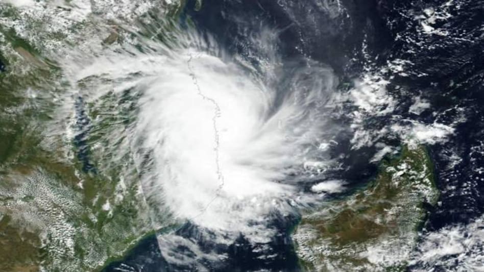
 Super Amphan cyclone update: IMD predicted very heavy rainfall in, Sikkim, Assam and Meghalaya till Wednesday, apart from Odisha and Bengal
 Super Amphan cyclone update: IMD predicted very heavy rainfall in, Sikkim, Assam and Meghalaya till Wednesday, apart from Odisha and Bengal
The India Meteorological Department (IMD) said on Monday that Cyclone Amphan has turned into a "super cyclonic storm" this morning and is likely to move across the northeast Bay of Bengal, and cross the West Bengal and Bangladesh coasts between Digha and the Hatia Island on May 20. In the midst of the coronavirus lockdown, three states - Odisha, Andhra Pradesh, and West Bengal - are preparing to face a possible storm, which is expected to make a landfall in Bengal on Wednesday. "It is very likely to move nearly northwards for some more time and then north-northeastwards across northwest Bay of Bengal and cross West Bengal - Bangladesh coasts between Digha (West Bengal) and Hatiya Islands (Bangladesh) close to Sundarbans during the Afternoon / Evening of 20th May 2020 as anExtremely Severe Cyclonic Storm with maximum sustained wind speed of 165-175 kmph gusting to 185 kmph," according to a statement released by Ministry of Earth Science. It also predicted very heavy rainfall in, Sikkim, Assam and Meghalaya till Wednesday, apart from Odisha and Bengal.
Here's is ten things you need to know about Super Amphan cyclone:
PM Modi reviews preparedness for Cyclone Amphan
PM Narendra Modi on Monday held a meeting with the Ministry of Home Affairs (MHA) and the National Disaster Management Authority (NDMA) to review the preparedness for Cyclone Amphan developing in the Bay of Bengal.
"Reviewed the preparedness regarding the situation due to cyclone 'Amphan.' The response measures as well as evacuation plans were discussed. I pray for everyone's safety and assure all possible support from the Central Government," the Prime Minister said in a tweet.
25 NDRF teams deployed on ground, 24 on standby
In the meeting with PM Modi, National Disaster Response Force(NDRF) DG Satya Narayan Pradhan informed that 25 NDRF teams have been deployed on the ground while 12 others are ready in reserve. Twenty four other NDRF teams have also are also been kept on standby in different parts of the country.
Odisha likely to be heavily impacted
Umashankar Das, scientist at IMD Bhubaneswar said that North Odisha would face the strongest impact of Amphan cyclone when it makes landfall. With wind speeds of up to 130 kmph, Balasore, Bhadrak, Jajpur, Mayurbhanj districts of the state are likely to be heavily impacted on May 20.
Also Read: Cyclone Amphan intensifies in Bay of Bengal; heavy rain, storm threat to Odisha, West Bengal
Rainfall warning in Sikkim, Assam and Meghalaya
The IMD has further issued heavy rainfall warning in Sikkim, Assam and Meghalaya till May 21. Most places would receive moderate rainfall while some would experience heavy rainfall.
Rainfall warning in West Bengal, Odisha
The IMD has issued a warning for very heavy rainfall in Odisha and West Bengal. East Medinipur, South 24 Parganas, North 24 Parganas, East and West Medinipur, Hooghly, Howrah and Kolkata are some of the districts in West Bengal that are likely to experience heavy rainfall till May 21. In Odisha, heavy rainfall is expected at isolated places across Gajapati, Ganjam, Puri, Jagatsinghpur, Jajpur, Balasore, Bhadrak, Mayurbhanj and Kendrapara districts.
Warning issued to fishermen
As Cyclone Amphan intensified into a severe cyclonic storm, fishermen have been advised not to venture into the sea, according to the Cyclone Warning Centre, Visakhapatnam on Sunday. The fishermen have been advised not to venture into west-central and adjoining central parts of south Bay of Bengal during next 24 hours, to central Bay of Bengal on May 19 and into North Bay of Bengal during May 19-20.
Fishermen have also been advised not to venture into North Bay of Bengal along and off North Odisha, West Bengal and adjoining Bangladesh coasts during May 18-20.
Odisha to evacuate over 1 million people
A year after it was hit by Cyclone Fani, Odisha is preparing to evacuate over 1 million people living in vulnerable areas, according to the state officials. Last year, the state had relocated over 11 lakh people across 13 districts.
NCMC reviews preparedness
On Saturday, National Crisis Management Committee (NCMC) met under Cabinet Secretary Rajiv Gauba to review the preparedness.
Wind warning
Squally wind speed reaching 45 to 55 kmph gusting to 65 kmph is likely to commence along and off south Odisha coast from evening on May 18, becoming 55 to 65 kmph gusting to 75 kmph extend to along and off north Odisha coast from morning on May 19 and along and off West Bengal coast from May 19 afternoon. It will gradually increase thereafter becoming 110 to 120 kmph gusting to 135 kmph along and off the above mentioned districts of North Odisha.
Gale wind speed reaching 165 to 175 kmph gusting to 195 kmph is likely along and off east Medinipur and north & south 24 Parganas districts and 100-110 kmph gusting to 120 kmph over Kolkata, Hooghly, Howrah and West Mednipur Districts of West Bengal during the time of landfall (May 20 afternoon to night).
Damage expected from cyclone
Extensive damage to all types of kutcha houses and some damage to old badly managed Pucca structures is expected. There is a potential threat from flying objects. Extensive uprooting of communication and power poles, while disruption of rail and road link at several places is also expected. Besides, large boats and ships may get torn from their moorings.