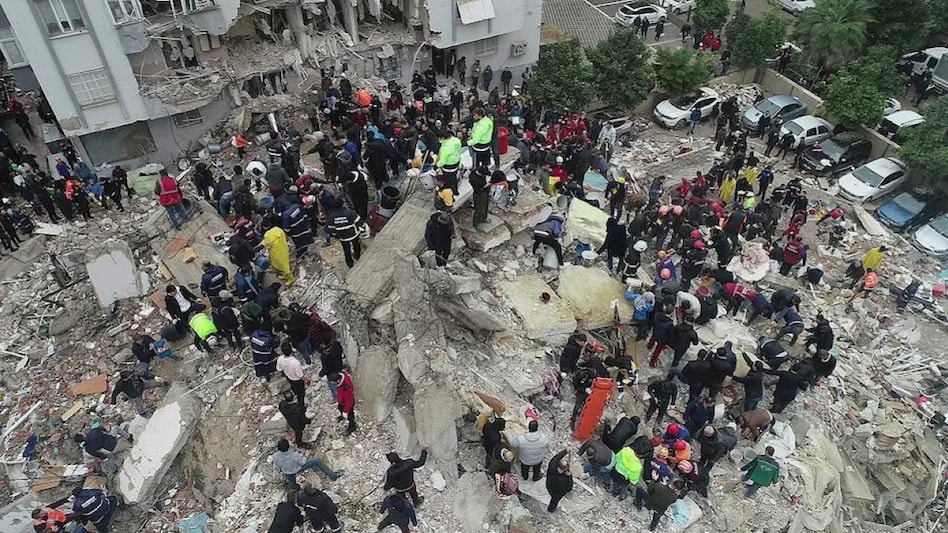
 Two scientists from the United States Geological Survey (USGS) recently explained why the damage was so extensive in Turkey.
 Two scientists from the United States Geological Survey (USGS) recently explained why the damage was so extensive in Turkey.
 Turkey-Syria earthquake: The strongest earthquake in decades in Turkey has caused massive damage, flattening thousands of buildings in the country and neghbouring Syria. So far, the death toll has surpassed 17,000 in both countries, and these numbers are likely to go up as many are still feared trapped under the rubble of collapsed buildings. Earlier this week, Turkish President Tayyip Erdogan called it a 'historic disaster' and the worst earthquake to hit Turkey since 1939.
Turkey Earthquake: Watch This Ground Report from Adana, Turkey
Two scientists from the United States Geological Survey (USGS) recently explained why the damage was so extensive in Turkey. In a note, USGS scientist David Wald said that it was difficult to watch this tragedy unfold, especially since the buildings in the region "were not designed to withstand earthquakes".
"An earthquake this size (7.8 magnitude) has the potential to be damaging anywhere in the world, but many structures in this region are particularly vulnerable," Wald added.
The earthquake of 7.8 magnitude struck south-central Turkey near the Syrian border in the early hours of Monday, February 6. Just 11 minutes later, an aftershock of 6.7 aftershocks hit the country. Not only this, but within hours, the country was struck by two more equally strong earthquakes, which brought down more buildings.
Turkey earthquake: 14-month-old baby, cat among rescued from under debris
According to reports, the earthquake brought down at least 6,000 buildings across the 10 provinces of Turkey, including hospitals and other public premises.
Kishor Jaiswal, another scientist at USGS, said the earthquake produced intense shaking in the epicentral region. He then explained why buildings were down like packs of cards. "While newer buildings in other parts of Turkey (like Istanbul) are designed with modern earthquake standards in mind, the area affected by this earthquake included more vulnerable buildings, like older types of concrete frames that were not designed from seismic considerations to absorb this much ground motion," the scientist said.
In a detailed note following the disaster, the American geological department said the quake occurred within the East Anatolian fault system and that aftershocks were expected to continue in the vicinity, which is a triple junction, a tectonically active area where three tectonic plates - Anatolia, Arabia, and Africa plates - touch and interact with each other.
By Monday evening, around 30 aftershocks magnitude 4.5 and larger had been recorded between the Mediterranean Sea, 60 miles to the southwest, and the city of Malatya, 200 km to the northeast. Since 1970, only three earthquakes of magnitude 6 or larger had been registered in this region, the geological department said, adding that the largest was of 6.7 magnitude that occurred on January 24, 2020.